V.
Suburbs nowadays
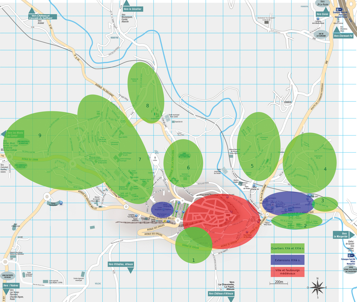
Like in many other cities, the Saint-Flour’s urban expansion is extremely recent. It is after 1945 that the residential, commercial and activity zones really appear. (See map, saint-flour nowaday)

1.
The suburb of Pré Poulou was started in 1954 by low cost housing company Le Foyer Cantalien. Next door in 1956, the subdivision of Pré Rongier comes out of the ground.
5.
In the district of Camiols, the industrial area along the creek dates from the early 1960s, the suburban area of 1974.
.
2.
In the neighbourhood of La Vigière from 1949 to 1983 are built: the Louis Thioleron’s State school (KS 1 and 2), the La Vigière’s collège (KS 3), the residence of the same name, retirement home and the houses around.
6.
In 1962, the Blaise Pascal’s Collège (KS3) opens its doors and houses appear along the Avenue de la Fontlong and Avenue Léon Bélard. The commercial zone below develops since 1982.
3.
Finally, the district of Montplain (of mons planus, the flat mount) develops, for the housing part since the 60’s and since 1970 for the large commercial area straddling the communes of Roffiac, Andelat and Saint -Flour.
7.
All the buildings around the old farm of Besserette, which gave its name to this quite big district, are less than 60 years old. To adapt to the new urban distribution, a kindergarten and State school opened in September 1980.
4.
. The district of Bel-Air (low cost buildings and houses) developed between 1965 and today. In 1986, the district of La Croix de Fer was added.
8.
The district of Le Champ du Barral is also the work of Le Foyer Auvergnat. An eco-district has been under development there since 2015.
9.
Finally, the district of Montplain (of mons planus, the flat mount) develops, for the housing part since the 60’s and since 1970 for the large commercial area straddling the communes of Roffiac, Andelat and Saint -Flour.

On the south hillside: the Pré Poulou, Pré Rongier and Fridières neighborhoods today, SFAM Coll.

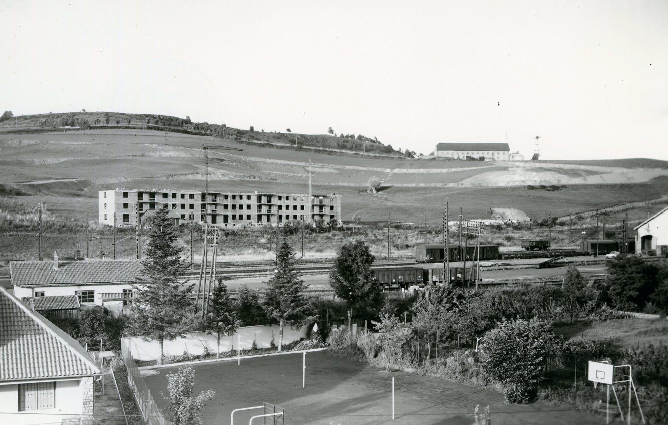
Buildings construction at Bel-Air in the 1960s.
